
I suppose that this would be a good spot to tell you a little about our destination. Lake Baikal is the world’s deepest lake (over 1600 meters at its deepest point) and it contains around 1/5 of the world’s fresh water. That’s more water than in all of America’s Great Lakes combined. The lake is an amazing habitat, home to large numbers of aquatic plants and animals found only in Lake Baikal, including the delicious omul fish and the adorable and endangered nerpa seal (yes, the one M wanted to eat). For more info on Lake Baikal, click here. Olkhon Island is the largest Island on the lake, stretching roughly 72 kilometers, and running north-east to south-west (although it’s only 15 kilometers wide). It is the traditional home to Buryats (the indigenous people of the region) and although it was discovered by Russian explorers in the 17th century, it was only colonized by Russians in the Soviet era. Currently the island is home to Buryats, Tatars and Russians. Only about 1200 people live on the island year-round, although apparently as many as 300 people/day visit the island during the summer.
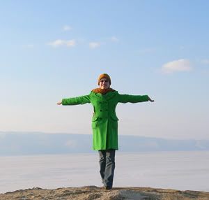
Anyhow, we arrived at our hostel, Solnechnaya, and immediately set out for a walk along the shore of the lake, where we took many photos, climbed trees and played on the ice.
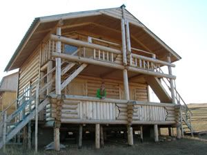
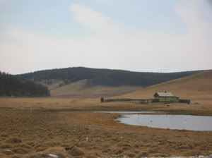
Our cabin
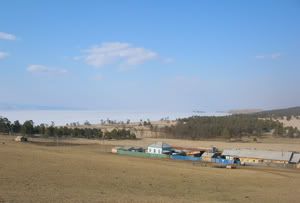
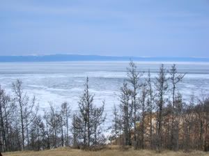
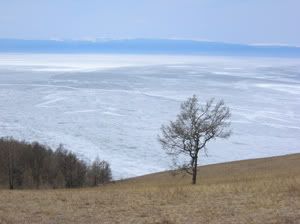
The view from our hostel
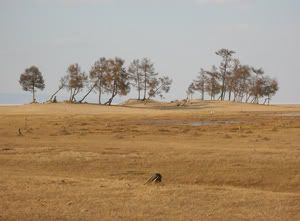
Trees on the shoreline
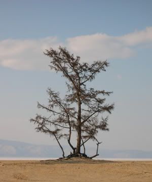
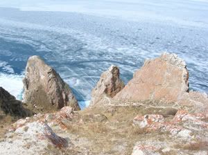
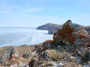
I liked the way this one looked a lot.
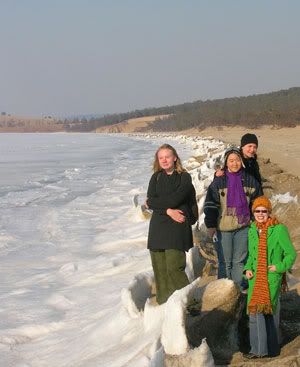
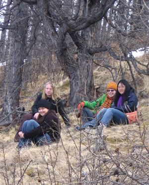
Girls on ice.
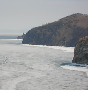
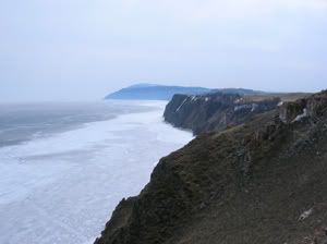
Frozen ice waves lined the beach.
During the winter, when the ice is firm enough, there is an ice-road, where vehicles drive to and from the island. At the point where the now impassable ice road, thinned from use, had begun to melt, J worked up the nerve to wade in. She wasn’t in there for too long, and said that this was the coldest water she’d ever felt. Coming from someone who took a dip in the Gulf of Finland last January, that’s saying a lot!
J freezes.
Y touches the waters of Baikal
We climbed along the edge of a nearby cliff... and then for some unknown reason we decided to climb up said cliff. I have taken to calling this the Cliff of Death, as we nearly slid to our deaths, and as I totally wrecked my knees again (although I didn’t feel it until the next morning), and when we reached the top, I kind of collapsed onto the ground for a while in relief and exhaustion.
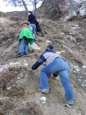
Climbing the Cliff of Death
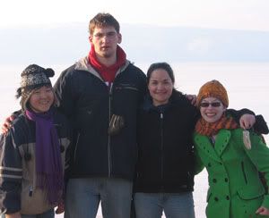
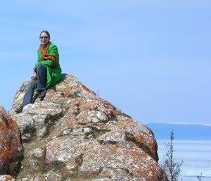
The triumph of victory!
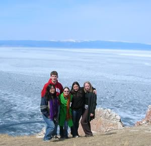
Y, M, J and me
after climbing th Cliff of Death
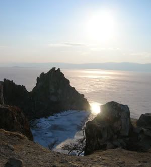
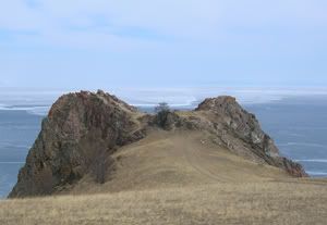
Once we recovered from our climb, we set off for the nearby rock formation known as Shamanka in Russian and Burkhan in Buryat. Burkhan is a sacred spot to shamanistic Buryats, and is supposedly a focal point of shamanic energy. It was incredibly beautiful.
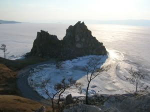
Burkhan (Shamanka)
Burkhan (Shamanka)
On the cliff overlooking Burkhan
We returned to our hostel for our first meal. Solnechnaya provided us with a cabin and three delicious meals a day for 650 rubles ($24) per night, which was an incredible deal. For those of you accustomed to traveling in Russia, I should warn you that the island lacks running water - so be prepared for pit toilets (pit squatters no less!) and “running water” powered by gravity. However, in compensation for the lack of modern amenities, this place feeds you quite well. Every meal was a mouth watering experience of delight. We ate a lot of omul, one of the fish endemic to Olkhon. I thought it was fantastic - and I don’t even like fish! After dinner, we hit up the Russian banya. I *love* banyas. You sit in the steam room and bake, while washing/scrubbing yourself using buckets of water (varying from scalding to frigid), and you get to hang out naked with your friends. It really doesn’t get any better.
The next morning I awoke to a terrible pain in my right knee. This is the same problem I developed on our trip to St. Petersburg last November, although not as severe, and only in one knee this time.) Nonetheless, after an amazing breakfast, I set out with the rest of the group on an excursion arranged for us by Valeriy. (It cost 600 rubles ($22) per person, but it lasted the entire day and was utterly incredible and most definitely worth the price.)
We all piled into the van (the one which had the flat tire the day before) And set off into the wilds of Olkhon with Ilyas, our guide. Ilyas was an ethnic Tatar from the area, with an incredible history (he had been in the Soviet Army and a Communist Party Apparatchik who quit the party in the mid-80s because he was tired of being lied to and having to lie to others. The man was incredibly smart and knew a lot about the history of the island and was very interesting to talk to in general. He was an exceptional guide, although it was all done in Russian... so non-Russian speakers would need a translator.) None of the roads on Olkhon are paved, and when you go north of Khuzhir the “roads” become little more than deep ruts through the wilderness... which our guide took at a frightening pace, quite frequently while looking back over his shoulder at us, narrating.
Our first stop was a holy totem, consecrated by Buryat Shamans. The totem is located in the center of two stone circles (not standing stones, but flat stones, embedded in the earth), which are approximately 100-150 yards in diameter. The inner circle represents earthly life, and the outer circle represents the cosmos and spiritual life. It is tradition for the locals to leave offerings at the totem, either by tying something on the totem itself or by leaving money, wine or cigarettes at its the base. Ilyas left a cigarette, and then we traveled on.
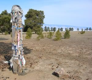
Holy totem.
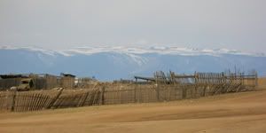
We came to another site with four totems, each of which represented a family in the nearby farming collective. Passersby left offerings of a similar nature here too, in order to honor those families and the spirits of the ancestors of those families.
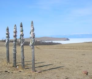
Totems representing the four families.
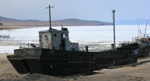
Later we visited the sire of an old fishing wharf and cannery (long since burned down), and saw the one remaining building from a political prisoner camp formerly located on the island. (If I’m ever a political prisoner, can it *please* be on Olkhon?)
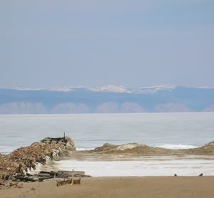
The old fishing wharf.
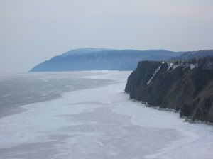
Then we drove on to see a variety of spectacular views...
Three Brothers rock formation
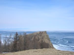
View of Hoboi, the northern tip of the island
M, Y, me, J, and Ingvild at the Three Brothers
View of Hoboi from a distance
Me, atop a rock
We drove as far north as possible, and then our driver pointed out a path that we could take to the tip of Hoboi. Unfortunately, at that point my right knee was killing me, and I figured that if I was lucky enough to make it out to the tip of Hoboi, I probably wouldn’t be able to make it back. So, while the others walked out to the tip of Hoboi, I took pictures of my surroundings and then had a short nap in the sun.
Hoboi from as close as I got, sigh...
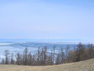
View from where I took my nap...
Similar view.
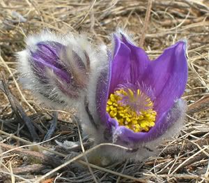
These purple flowers were everywhere and quite awesome.
I wish I knew what they were called!
Ilyas had driven off and parked the van out of the wind in order to cook our lunch. When the others returned from Hoboi, I hobbled down the hill to the van, and discovered Ilyas cooking fish soup (with omul, of course) over an open flame. We each received a whole fish in our soup, and learned that the fish eye pops out of the socket, that means the fish is cooked. I know it looks scary, but it was actually quite delicious.
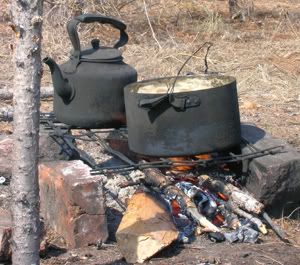
Lunch cooking.
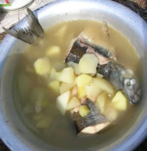
When the eyeball pops out, you know the fish is cooked.
After lunch, we sat for a while on a cliff overlooking the lake.
Our next stop was the Man and the Woman who form the Lover’s Heart rock formation. The larger rock on the left is the “man” and the smaller one on the right is the “woman.” The views from here were, of course, spectacular.
Lover's Rock.
View from Lover's Rock
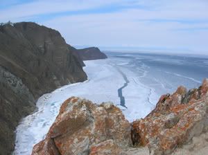
View from Lover's Rock
View from Lover's Rock
Then we drove to a tiny settlement (too small even to be called a village) in a valley along the shore. In this settlement, a seismograph is located. Ilyas didn’t seem to know why (“To give jobs to students.”), but after doing a little research, I can guess why. See, Lake Baikal is located at the separation point of two tectonic plates. There are many teeny-tiny earthquakes here every day, as the crack between the plates widens. Every now and then there are earthquakes in this area registering 3-4 on the Richter scale... and, about 160 years ago, there was a huge earthquake in this area which caused a huge part of the southern shore (near the Selenga Delta) to fall into the lake. In a few million years, give or take, Baikal will become the world’s newest ocean.
Valley where the seismograph is located.
That was the last stop on our excursion, and the last of our adventures that day. The next morning, we arose and decided to explore the village of Khuzhir. The village is tiny, and has only a handful of stores. I purchased souvenirs (rocks from the lake painted to look like nerpas and shamans). We walked down to the wharf, which to me seemed depressingly beautiful and utterly abandoned, although perhaps it is a functional area once the ice has melted. We explored the remains of another burnt out fish cannery, then climbed up to the top of the hill to view the small (and very new) Orthodox church, and to photograph the harbor from a good vantage point.
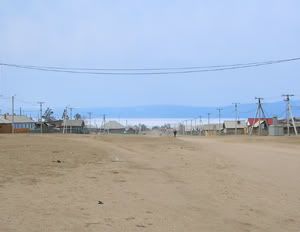
The empty streets of Khuzhir
Mountains, as seen from Khuzhir
Old boats in the wharf
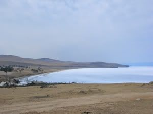
View of Baikal from above the village
At that point, it was time for lunch. Not willing to miss out on a meal at Solnechnaya, we scurried back. After lunch, the weather grew cold, damp and unpleasant. We didn’t want to spend too much time outside, so we decided to see if the museum was open. We had been told by Valeriy that the museum was excellent for a museum covering life on an island with such a tiny population. The museum is named after a Mr. Revyakin, a teacher and founder of the museum, and it contains exhibits representing the traditional lifestyles of the Buryats and the original Russian settlers, as well as exhibits on the plant and animal life endemic to Baikal. To be honest, the best part of the museum was its docent, a tiny woman (shorter than me and Youngmee) in her upper sixties, who was passionate about the museum and its contents, and who turned out to be the daughter of Revyakin, the museum’s founder. After hearing how and when the five of us had crossed the lake, she had us gather around an old motorcycle that was on display, and she told us the following story:
The motorcycle belonged to Mr. Revyakin. One day in early May (!) Revyakin and a friend decided to cross the ice on his motorcycle, as the ice seemed thick and firm. The friend was carrying a large and heavy bag of fish, which was strapped to his back. They were in the process of crossing the lake when suddenly the ice broke, and the two men and the motorcycle fell through. Revyakin was able to climb free, then he had to cut the bag of fish off of his friend’s back, in order to pull him out of the ice. The two men were lucky to reach the shore alive. Two years later, a fisherman “caught” the motorcycle in his net. Revyakin cleaned it up, put some gasoline in the tank, and it worked! The moral of the story for us was that under no circumstances were we to cross by motorcycle on our way back to the mainland. Luckily for us, she told us that the ice at the narrow Olkhon Straits would be melted enough for us to cross the following day by boat.
We returned to Solnechnaya for dinner, after which the others walked down to Burhan to watch the sunset. (Sadly, I had to remain in the cabin resting my knee.) After the sun set, it was time for our final Banya together at Solnechnaya. By this point we were all feeling quite silly... and brought our cameras into the banya. We took a lot of hilarious (though tasteful) nudie pics (or semi-nude, with strategically placed buckets and towels and such) although sorry... I’m only posting two on the blog ;-)
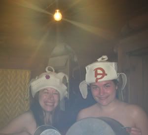
Jane and Joanna in the banya. Don't ask about the hats.
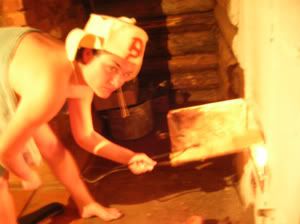
We took great care to pose this one. It's entitled,
"Stoking the Fires of Socialist Realism"
(That's J, by the way!)
Stay tuned for Part 4: Olkhon to Irkutsk to Moscow!
3 comments:
Thank you for the wonderful story telling! I've always wanted to go to Baikal, dunno if I ever will, but now I feel like I know it....
Natalya (in NY)
HAHAHAHAH man that is absolutely hilarious.
L.
Hi Jane,
What an incredible adventure ……that lake is so beautiful…and so surreal …keep posting more :-)
Post a Comment